What are the main sources of methane gas?
Methane has made its home in the atmosphere through various anthropogenic and natural causes.
While it’s completely natural for decaying organic matter, wetlands, termites, and oceans to release certain levels of this gas, adding human practices into the mix has astronomically accelerated the number of methane particles floating around up there.
Landfills, oil and gas systems, coal mining, agricultural activities, mobile combustion, wastewater treatment, and other human-driven industrial processes are all known sources of methane emissions.
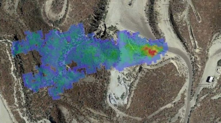
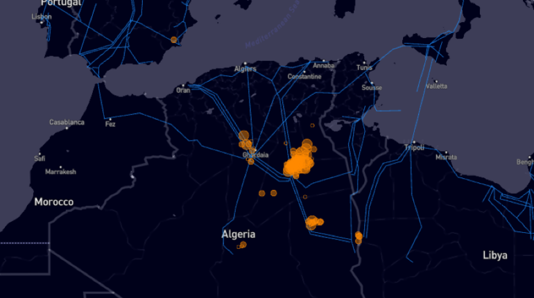
This is demonstrated in the satellite image below, where orange dots show newly discovered ‘methane plumes’ leaking from a gas field in Northern Africa. Researchers say these emissions have likely been emptying into our atmosphere undetected for decades.
How the UN’s new program will help
The new project is called the Methane Alert and Response System (MARS), and is building on an agreement to slash methane emissions by 30 percent before 2030. The agreement was signed by 119 countries at last year’s COP summit.
MARS will use already deployed satellites to snap imagery of methane plumes detected around the world. It will also gather data on their size and locate which business or government is responsible for it.
This information will be presented to the offender, giving those in charge of repairing the leak the opportunity to do so. After 45-75 days, MARS will release information about the leak and the company’s action (or inaction) to the public.
The UN’s environmental watchdog believes that satellite images of methane leaks will help governments and corporations to become more aware of their damaging practices – if they didn’t know about them already.
It’s also worth noting that a public database of MARS’ kind will offer activists and climate-focused associations further fact-based ammunition when calling out apathetic organisations.
Those involved in funding the MARS project are Jeff Bezo’s Earth Fund, the Global Methane Hub, as well as US and EU governments. Let’s hope the tangible evidence will spark action that eliminates one of the world’s most potent greenhouse gases.